1-234-765-4967
English
Sign Up
Login
Username
Password
Login
Forgot Password?
Login without Signup
Professional software for photographers
Toggle navigation
Files
Stock
Photo
Video
Audio
Vector
Special offer
Collections
Packages
Lightboxes
Licenses
Royalty free
Rights managed
Creative
Editorial
Items
Most downloaded
Featured
Most popular
New
Free
Prints
Wall Art
Canvas Prints
Framed Prints
Prints and Posters
Metal Prints
Acrylic Prints
Phone Cases
iPhone Cases
Galaxy Cases
Home Decor
Pillows
Duvet Covers
Shower Curtain
Clothes
T-Shirts
Souvenirs
Greeting Cards
Bags
Tote Bags
Categories
Browse categories
Site info
Site info
About
Support
Privacy Policy
FAQ
Contact Us
Customers
Users
Credits
Subscription
Photographers
Boby Richards
1
Your Shopping Cart is empty.
Home
Catalog
Close-up of orange LIDAR tech equipment for terrain elevation analysis, landscape mapping in nature. 3D scanner on tripod for geographic exploration, environmental research and optic surveying.
Download sample
File Details
Published:
2025-03-11 17:27:51.045740
Category:
Food
Type:
Photo
Model release:
No
Share
Contributor:
miss irine
ID : 1324439328
Files
Prints and Products
Title
Filesize
Photo
5376x3072
Buy on Adobe Stock
Title
Price
Buy
Wall Art
Canvas Prints
30 EUR or Credits
Framed Prints
10 EUR or Credits
Prints and Posters
5 EUR or Credits
Metal Prints
10 EUR or Credits
Acrylic Prints
10 EUR or Credits
Phone Cases
iPhone Cases
30 EUR or Credits
Galaxy Cases
30 EUR or Credits
Home Decor
Pillows
18 EUR or Credits
Duvet Covers
100 EUR or Credits
Shower Curtain
50 EUR or Credits
Clothes
T-Shirts
20 EUR or Credits
Souvenirs
Greeting Cards
3 EUR or Credits
Bags
Tote Bags
20 EUR or Credits
Order print
Keywords
technology
,
equipment
,
camera
,
measurement
,
precision
,
imaging
,
surveying
,
datum
,
analysis
,
landscape
,
elevation
,
terrain
,
mapping
,
detail
,
nature
,
science
,
research
,
innovation
,
tool
,
device
,
exploration
,
environment
,
optical
,
geographic
,
tripod
,
orange
,
topographic
,
remote sensing
,
forestry
,
geology
,
archaeology
,
construction
,
engineering
,
transportation
,
planning
,
agriculture
,
robotic
,
drone
,
aerial
,
datum
,
model
,
digital
,
global positioning system
Related items
 English
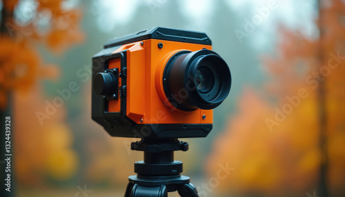
)